Address
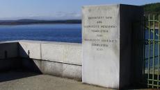
Oakham Field Office Ware River Watershed, Oakham, MA 01068

N/A
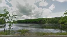
Recreational activities available in the Ware River watershed include:
Click here to use the on-line interactive Public Access Map.
DCR permits public access and recreational activities which are compatible with protection of the drinking water supply, and these other objectives:
The primary purpose of DCR watershed lands is drinking water supply. Public access, therefore, is carefully regulated and controlled to protect 2.7 million people’s source of drinking water. State regulations require all entry and exit through gates or other designated areas only. Anything that could pollute the water supply system, such as litter or refuse of any sort, is prohibited. Please observe restrictions on recreational activities. Direct water contact activities, such as swimming and wading, are strictly prohibited by regulation. Unmanned Aerial Vehicles (“Drones”) are not allowed.
DCR's Ware River Watershed Public Access Management Plan describes the management policies that allow people to recreate on Ware River watershed lands while still protecting water quality. The Division of Water Supply Protection completed the Ware River Watershed Public Access Management Plan Update (2023) in September 2023. 2023 Ware River Watershed Public Access Management Summary provides an overview of these polices by activity.
The Division of Water Supply Protection has developed an interactive map with detailed information about public access roads and trails around the Ware River watershed. There are two ways to access this map: one is an online program that is accessible from your desktop computer or mobile device’s web browser; the other is through an App you can download directly to your mobile device and use in the field. The mobile device App is recommended for use in the field.
Click here to directly access the on-line interactive Public Access Map.
Please see the Instructions for Using DCR Division of Water Supply Protection's Public Access Maps in ArcGIS Field Maps for information about the mobile app.